This is an example of a HTML caption with a link.

Artículos mas leídos

    Tizimín.

    La ciudad de los reyes magos, donde las leyendas se mezclan con la religión.

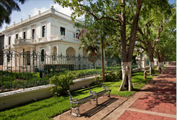
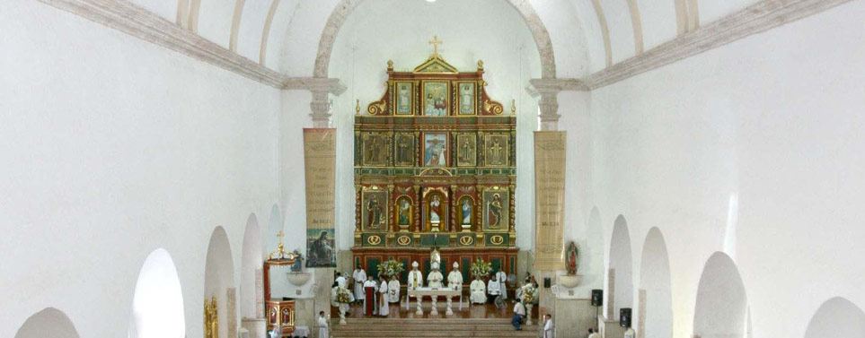
    Tizimín antiguo pueblo maya de los cupules, dotado de una gran belleza colonial que podemos admirar en sus iglesias y su sabrosa cocina regional. Un pueblo mágico muy apegado a sus tradiciones y costumbres que perduran desde la época colonial.

    Mas información

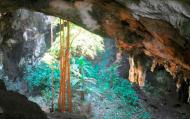
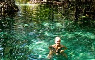
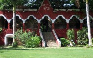
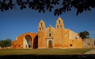
    Entre los puntos a visitar se encuentran la antigua estación de ferrocarriles de principios del siglo XX; el cenote e iglesia de Kikil, al norte de la ciudad; el ex convento y parroquia de los Santos Reyes del siglo XVII; Las Catacumbas, cuevas en las cuales artesanos de la ciudad recrean imágenes y figuras populares y de animales; el Parque Zoológico Botánico La Reina, nombrado así, en honor a la Reina Isabel II de Inglaterra, quien lo inauguró el 28 de febrero de 1975, en su visita a la ciudad. Y el yacimiento arqueológico de Kulubá.

    Ubicación y Actividades

    Tizimín,Yucatan. Historia

    Precio

    Las Catacumbas son unas cuevas donde hay retratos labrados que son muy interesantes y divertidos de explorar, la entrada cuesta 10 pesos aprox.

    Como llegar

    Desde Mérida se puede llegar:
    • En auto tomando la carretera Mérida-Motul-Tizimín No.176. En total son 167 km.
    • En autobús se llega tomando el autobús con ruta Mérida-Tizimín en la terminal de autobuses del noreste ubicada en la calle 67 N 551, Centro, Mérida.

    Horarios

    Se puede entrar a la ciudad las 24 horas.

    Recomendaciones e Información

    Debe considerar llevar ropa y calzado cómodos, bloqueador solar para disfrutar de su calles y visitar los sitios coloniales que Tizimín ofrece. Si tiene la oportunidad llévese los recuerdos que pueda, infórmese bien del clima para que la lluvia no lo sorprenda en su visita. Recuerde que es importante respetar y mantener limpio el espacio que está visitando.

    Servicios

    Hospedaje, Renta de casas/habitaciones, Restaurantes, transporte terrestres, artesanías, supermercado, bancos, casas de cambio, gasolineras.

    Sitios Cercanos de Interés

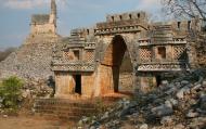
    Tizimín puede ser un buen punto de partida a lugares cercanos como el Parque Nacional de la Reserva de la Biósfera de Río Lagartos, las ciudades costeras de El Cuyo y San Felipe. Así mismo sitios arqueológicos de la cultura maya de Ek Balam y Chichén Itzá.

    Sitio Web

    tizimin.gob.mx
    comments powered by Disqus
    Tizimín.
    '+'

    '+'

    '+'
    '+''; infowindow = new google.maps.InfoWindow({content: contentString}); $(".btnlocation").click(function(){ showMyPosition(); }); $("#pinsdebusquedaclose").click( function(event){ event.preventDefault(); $("#pinsdebusquedaclose").hide(); $("#pinsdeseccion").show(); $("#pinsdebusqueda").hide(); searchingpins=false; showhide(); } ); $("#frmMaps").submit(function(){ if(searchingpins==false){ var tags = $("#frmMaps .txtbuscar").val(); if(tags==''){ // escriba el termino de busqueda }else{ if(ultimabusqueda != tags){ $("#pinsdebusquedaresults").html(""); $("#pinsdebusquedaclose").show(); $("#pinsdeseccion").hide(); $("#pinsdebusqueda").show(); $("#pinsdebusquedawait").show(); $.post("buscarmarcadores.php",{tags:tags},function(data){ $("#pinsdebusquedawait").hide(); $("#pinsdebusquedaresults").html(data); searchingpins=false; showhide(); }); searchingpins=true; }else{ $("#pinsdebusquedaclose").show(); $("#pinsdeseccion").hide(); $("#pinsdebusqueda").show(); } ultimabusqueda = tags; } } return false; }); showhide(); } /** * Data for the markers consisting of a name, a LatLng and a zIndex for * the order in which these markers should display on top of each * other. */ function showhide(){ for(i in allmarkers) { allmarkers[i].setMap(null); } allmarkers = null; allmarkers = Array(); // show checked Markers if( $('#pinsdebusqueda').is(":visible") ){ selector = 'pinsdebusqueda'; }else{ selector = 'pinsdeseccion'; } var current=''; var enabled=''; var markercollection = Array(); var pin = Array(); $('#'+selector+' .markeritem').each(function(i,item){ current = $(this); enabled = current.is(':checked'); if( enabled ){ pin = []; pin.push( current.attr('data-title') ); pin.push( current.attr('data-lat') ); pin.push( current.attr('data-lng') ); pin.push( current.attr('data-icon') ); pin.push( current.attr('data-anim') ); markercollection.push( pin ); } }); setMarkers(map, markercollection, 'images/icons/marker.png'); } function setMarkers(map, locations, markerimage) { // Add markers to the map // Marker sizes are expressed as a Size of X,Y // where the origin of the image (0,0) is located // in the top left of the image. // Origins, anchor positions and coordinates of the marker // increase in the X direction to the right and in // the Y direction down. var imagesize = new google.maps.Size(45, 64); var imageorigin = new google.maps.Point(0,0); var imageanchor = new google.maps.Point(22, 64); var image = { url: markerimage, // This marker is 20 pixels wide by 32 pixels tall. size: imagesize, // The origin for this image is 0,0 origin: imageorigin, // The anchor for this image is the base of the flagpole at 0,32. anchor: imageanchor }; var shadow = { url: markerimage, // The shadow image is larger in the horizontal dimension // while the position and offset are the same as for the main image. size: new google.maps.Size(45, 64), origin: new google.maps.Point(0,0), anchor: new google.maps.Point(0, 64) }; // Shapes define the clickable region of the icon. // The type defines an HTML <area> element 'poly' which // traces out a polygon as a series of X,Y points. The final // coordinate closes the poly by connecting to the first // coordinate. var shape = { coord: [1, 1, 1, 50, 40, 50, 40 , 1], type: 'poly' }; var lastimgsrc=''; for (var i = 0; i '+'
    '+'
    '+'

    '+'

    '+myloc[0]+'

    '+'
    '+''; google.maps.event.addListener(marker, 'click', function() { infowindow.setContent(this.html); infowindow.open(map, this); }); allmarkers.push(marker); } } function showMyPosition(){ // Try HTML5 geolocation if(navigator.geolocation) { navigator.geolocation.getCurrentPosition(function(position) { var pos = new google.maps.LatLng(position.coords.latitude, position.coords.longitude); var infowindow = new google.maps.InfoWindow({map: map,position: pos,content: 'Tu posición actual'}); map.setCenter(pos); }, function() { handleNoGeolocation(true); }); } else { // Browser doesn't support Geolocation handleNoGeolocation(false); } } function handleNoGeolocation(errorFlag) { if (errorFlag) { var content = 'Error: Servicio de Geolocalizacion no disponible.'; } else { var content = 'Error: Tu navegador no es compatible con geolocalizacion.'; } var options = {map: map,position:new google.maps.LatLng(60, 105),content:content}; var infowindow = new google.maps.InfoWindow(options); map.setCenter(options.position); } // The function to trigger the marker click, 'id' is the reference index to the 'markers' array. var lastmarker=null; function showInfo(lat,lng){ pos=-1; if(lastmarker!=null){ allmarkers[lastmarker].setAnimation(null); } $('#'+selector+' .markeritem').each(function(i,item){ current = $(this); if( current.is(':checked') ){ pos++; } if( lat == current.attr('data-lat') && lng == current.attr('data-lng')){ lastmarker=pos; google.maps.event.trigger(allmarkers[pos], 'click'); allmarkers[pos].setAnimation(google.maps.Animation.BOUNCE); return false; } }); } google.maps.event.addDomListener(window, 'load', initialize);

    Mapa

    ¿Donde estoy?
    [+]
    [+]
    [+]
    [+]
    Ver mapa en pantalla completa Ver mapa en pantalla completa

    Mas sugerencias