This is an example of a HTML caption with a link.

Artículos mas leídos

    Conkal

    Conkal, un poco de historia del estado de Yucatán.

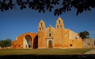
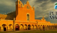
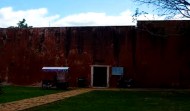
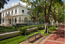
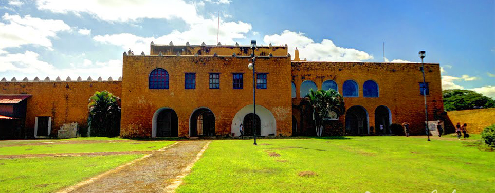
    Conkal es un pueblo pequeño que guarda muy bien su historia. Posee uno de los ex conventos más antiguos de Yucatán, actualmente en función de museo, es perfecto para conocer la historia de este bello lugar.

    Mas información

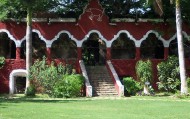
    Visite las haciendas cercanas y compruebe que la vida es tranquila y llena de paz. Conkal los espera con platillos exquisitos hechos para gusto de locales y extrajeros. Visite, viva Conkal.

    Ubicación y Actividades

    Conkal,Yucatan. Pueblo colonial

    Como llegar

    • Para llegar a Conkal desde Mérida en auto dirígete hacia el este en Calle 39 hacia Calle 52, tome la avenida Alemán (calle 4 y 17), entroncar con avenida Yucatán (calle 17), tome la carretera federal 178 Mérida-Motul, condusca hasta el puente, bajando de él habrá una desviación hacia la izquierda que lo llevará a Conkal.
    • Para ir en autobús, se toma en la terminal Noreste (calle 60 x 50 centro) tel. 924 63 55. el boleto tiene un costo de $10 pesos.


    Recomendaciones e Información

    Debe considerar llevar ropa y calzado cómodos, bloquedor solar para disfrutar de su calles y visitar los sitios de interés como el ex convento ahora museo, infórmese bien del clima para que la lluvia no lo sorprenda en su visita. Recuerde que es importante respetar y mantener limpio el espacio que está visitando.

    Servicios

    Servicios de Hospedaje en pequeños hoteles así como casas en renta, comida típica, internet, farmacias, ayuda médica, servicio de taxis y tricitaxis para recorrer el pueblo, teléfonos públicos, gasolinera, no hay bancos.

    Sitios Cercanos de Interés

    Termine de disfrutar visitando los poblados cercanos a Conkal donde hay gran similitud en su gente y sus fiestas. Visite Chablecal, Chicxulub pueblo, Ixil, Tekat, Mocochá y muchos más que harán de su visita a Conkal algo más.
    comments powered by Disqus
    Conkal
    '+'

    '+'

    '+'
    '+''; infowindow = new google.maps.InfoWindow({content: contentString}); $(".btnlocation").click(function(){ showMyPosition(); }); $("#pinsdebusquedaclose").click( function(event){ event.preventDefault(); $("#pinsdebusquedaclose").hide(); $("#pinsdeseccion").show(); $("#pinsdebusqueda").hide(); searchingpins=false; showhide(); } ); $("#frmMaps").submit(function(){ if(searchingpins==false){ var tags = $("#frmMaps .txtbuscar").val(); if(tags==''){ // escriba el termino de busqueda }else{ if(ultimabusqueda != tags){ $("#pinsdebusquedaresults").html(""); $("#pinsdebusquedaclose").show(); $("#pinsdeseccion").hide(); $("#pinsdebusqueda").show(); $("#pinsdebusquedawait").show(); $.post("buscarmarcadores.php",{tags:tags},function(data){ $("#pinsdebusquedawait").hide(); $("#pinsdebusquedaresults").html(data); searchingpins=false; showhide(); }); searchingpins=true; }else{ $("#pinsdebusquedaclose").show(); $("#pinsdeseccion").hide(); $("#pinsdebusqueda").show(); } ultimabusqueda = tags; } } return false; }); showhide(); } /** * Data for the markers consisting of a name, a LatLng and a zIndex for * the order in which these markers should display on top of each * other. */ function showhide(){ for(i in allmarkers) { allmarkers[i].setMap(null); } allmarkers = null; allmarkers = Array(); // show checked Markers if( $('#pinsdebusqueda').is(":visible") ){ selector = 'pinsdebusqueda'; }else{ selector = 'pinsdeseccion'; } var current=''; var enabled=''; var markercollection = Array(); var pin = Array(); $('#'+selector+' .markeritem').each(function(i,item){ current = $(this); enabled = current.is(':checked'); if( enabled ){ pin = []; pin.push( current.attr('data-title') ); pin.push( current.attr('data-lat') ); pin.push( current.attr('data-lng') ); pin.push( current.attr('data-icon') ); pin.push( current.attr('data-anim') ); markercollection.push( pin ); } }); setMarkers(map, markercollection, 'images/icons/marker.png'); } function setMarkers(map, locations, markerimage) { // Add markers to the map // Marker sizes are expressed as a Size of X,Y // where the origin of the image (0,0) is located // in the top left of the image. // Origins, anchor positions and coordinates of the marker // increase in the X direction to the right and in // the Y direction down. var imagesize = new google.maps.Size(45, 64); var imageorigin = new google.maps.Point(0,0); var imageanchor = new google.maps.Point(22, 64); var image = { url: markerimage, // This marker is 20 pixels wide by 32 pixels tall. size: imagesize, // The origin for this image is 0,0 origin: imageorigin, // The anchor for this image is the base of the flagpole at 0,32. anchor: imageanchor }; var shadow = { url: markerimage, // The shadow image is larger in the horizontal dimension // while the position and offset are the same as for the main image. size: new google.maps.Size(45, 64), origin: new google.maps.Point(0,0), anchor: new google.maps.Point(0, 64) }; // Shapes define the clickable region of the icon. // The type defines an HTML <area> element 'poly' which // traces out a polygon as a series of X,Y points. The final // coordinate closes the poly by connecting to the first // coordinate. var shape = { coord: [1, 1, 1, 50, 40, 50, 40 , 1], type: 'poly' }; var lastimgsrc=''; for (var i = 0; i '+'
    '+'
    '+'

    '+'

    '+myloc[0]+'

    '+'
    '+''; google.maps.event.addListener(marker, 'click', function() { infowindow.setContent(this.html); infowindow.open(map, this); }); allmarkers.push(marker); } } function showMyPosition(){ // Try HTML5 geolocation if(navigator.geolocation) { navigator.geolocation.getCurrentPosition(function(position) { var pos = new google.maps.LatLng(position.coords.latitude, position.coords.longitude); var infowindow = new google.maps.InfoWindow({map: map,position: pos,content: 'Tu posición actual'}); map.setCenter(pos); }, function() { handleNoGeolocation(true); }); } else { // Browser doesn't support Geolocation handleNoGeolocation(false); } } function handleNoGeolocation(errorFlag) { if (errorFlag) { var content = 'Error: Servicio de Geolocalizacion no disponible.'; } else { var content = 'Error: Tu navegador no es compatible con geolocalizacion.'; } var options = {map: map,position:new google.maps.LatLng(60, 105),content:content}; var infowindow = new google.maps.InfoWindow(options); map.setCenter(options.position); } // The function to trigger the marker click, 'id' is the reference index to the 'markers' array. var lastmarker=null; function showInfo(lat,lng){ pos=-1; if(lastmarker!=null){ allmarkers[lastmarker].setAnimation(null); } $('#'+selector+' .markeritem').each(function(i,item){ current = $(this); if( current.is(':checked') ){ pos++; } if( lat == current.attr('data-lat') && lng == current.attr('data-lng')){ lastmarker=pos; google.maps.event.trigger(allmarkers[pos], 'click'); allmarkers[pos].setAnimation(google.maps.Animation.BOUNCE); return false; } }); } google.maps.event.addDomListener(window, 'load', initialize);

    Mapa

    ¿Donde estoy?
    [+]
    [+]
    [+]
    [+]
    Ver mapa en pantalla completa Ver mapa en pantalla completa

    Mas sugerencias