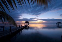
This is an example of a HTML caption with a link.

Artículos mas leídos

    Maní

    Lugar donde todo pasó.

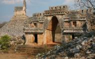
    Sobre la fundación de Maní, "lugar donde todo pasó", no hay datos exactos, pero se sabe que existe desde la colonización. En la época prehispánica fué cacicazgo de Maní de Tutul Xiu y fue centro ceremonial donde se enviaban ofrendas para el festival anual en honor a Kukulcán.

    Mas información

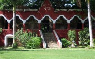
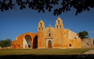
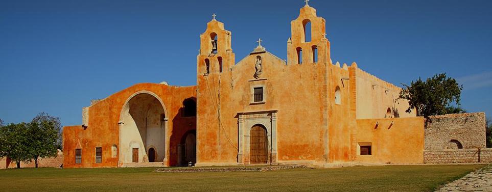
    Después de la destrucción de Mayapán, Maní fue uno de los cacicazgos en que quedó dividida la península con Tutul Xiu como su señor; de allí la leyenda sobre su nombre "todo pasó". Fue este cacique quien estableció la alianza con Montejo contribuyendo al éxito de la conquista. El convento de Maní fue el tercero en fundarse en 1549 ysu advocación fue San Miguel Arcángel cuya escultura luce en el frontal central de la fachada. En la historia de Maní se habla de un famoso y triste "auto de fé" celebrado por los franciscanos bajo el mando de fray Diego de Landa, a causa de la idolatría del pueblo maya. El auto de fe de Maní fue un suceso ocurrido el 12 de julio de 1562, en el que fueron incinerados un número considerable de imágenes de culto, objetos sagrados y códices de la cultura maya. Fue la conclusión de un proceso inquisitorial iniciado como se ha mencionado anteriormente por Diego de Landa con el apoyo del alcalde mayor contra los indígenas que mantenían un adoratorio clandestino en la región. Hoy en día maní es un pueblo tranquilo, cuando se le visita es casi imposible dejar de mirar su belleza que conserva desde su construcción hasta la actualidad ya que tiene el aspecto de una gran fortaleza. Ahora, podemos encontrar una pintoresca población que conserva sus costumbres mayas y su esencia colonial, la cual podemos observar y apreciar en las fachadas de los edificios que se conservan desde la colonización. 

    Ubicación y Actividades

    Maní,Yucatan. Historia y Gastronomía.

    Como llegar

    Este municipio tiene varios accesos, una por la antigua carretera a Chetumal desviándose en la ciudad de Ticul y pasando en el municipio de Dzan, alcanzando la altura del municipio de Oxkutzcab que se encuentra a 10km. Del lugar, otro acceso es en la carretera ?Ruta de los Conventos.?

    Recomendaciones e Información

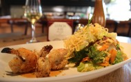
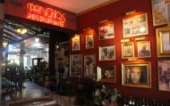
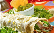
    También puede aprovechar y comer en el famoso y muy emblemático restaurante de comida típica "El principe Tutul Xiu", donde podrá degustar del famoso platillo llamado "Poc Chuc".

    Servicios

    Restaurantes, Farmacias, Iglesias, y servicios generales.

    Sitios Cercanos de Interés

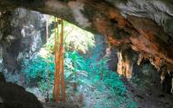
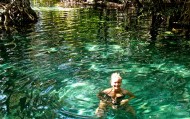
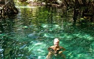
    A unos escasos 100mts. Se encuentra el Cenote XCabachen en donde el Príncipe Tutul Xiu Adquiría del líquido vital (agua) junto con toda su gente después de la Batalla que tuviera con los Cocom.
    comments powered by Disqus
    Maní
    '+'

    '+'

    '+'
    '+''; infowindow = new google.maps.InfoWindow({content: contentString}); $(".btnlocation").click(function(){ showMyPosition(); }); $("#pinsdebusquedaclose").click( function(event){ event.preventDefault(); $("#pinsdebusquedaclose").hide(); $("#pinsdeseccion").show(); $("#pinsdebusqueda").hide(); searchingpins=false; showhide(); } ); $("#frmMaps").submit(function(){ if(searchingpins==false){ var tags = $("#frmMaps .txtbuscar").val(); if(tags==''){ // escriba el termino de busqueda }else{ if(ultimabusqueda != tags){ $("#pinsdebusquedaresults").html(""); $("#pinsdebusquedaclose").show(); $("#pinsdeseccion").hide(); $("#pinsdebusqueda").show(); $("#pinsdebusquedawait").show(); $.post("buscarmarcadores.php",{tags:tags},function(data){ $("#pinsdebusquedawait").hide(); $("#pinsdebusquedaresults").html(data); searchingpins=false; showhide(); }); searchingpins=true; }else{ $("#pinsdebusquedaclose").show(); $("#pinsdeseccion").hide(); $("#pinsdebusqueda").show(); } ultimabusqueda = tags; } } return false; }); showhide(); } /** * Data for the markers consisting of a name, a LatLng and a zIndex for * the order in which these markers should display on top of each * other. */ function showhide(){ for(i in allmarkers) { allmarkers[i].setMap(null); } allmarkers = null; allmarkers = Array(); // show checked Markers if( $('#pinsdebusqueda').is(":visible") ){ selector = 'pinsdebusqueda'; }else{ selector = 'pinsdeseccion'; } var current=''; var enabled=''; var markercollection = Array(); var pin = Array(); $('#'+selector+' .markeritem').each(function(i,item){ current = $(this); enabled = current.is(':checked'); if( enabled ){ pin = []; pin.push( current.attr('data-title') ); pin.push( current.attr('data-lat') ); pin.push( current.attr('data-lng') ); pin.push( current.attr('data-icon') ); pin.push( current.attr('data-anim') ); markercollection.push( pin ); } }); setMarkers(map, markercollection, 'images/icons/marker.png'); } function setMarkers(map, locations, markerimage) { // Add markers to the map // Marker sizes are expressed as a Size of X,Y // where the origin of the image (0,0) is located // in the top left of the image. // Origins, anchor positions and coordinates of the marker // increase in the X direction to the right and in // the Y direction down. var imagesize = new google.maps.Size(45, 64); var imageorigin = new google.maps.Point(0,0); var imageanchor = new google.maps.Point(22, 64); var image = { url: markerimage, // This marker is 20 pixels wide by 32 pixels tall. size: imagesize, // The origin for this image is 0,0 origin: imageorigin, // The anchor for this image is the base of the flagpole at 0,32. anchor: imageanchor }; var shadow = { url: markerimage, // The shadow image is larger in the horizontal dimension // while the position and offset are the same as for the main image. size: new google.maps.Size(45, 64), origin: new google.maps.Point(0,0), anchor: new google.maps.Point(0, 64) }; // Shapes define the clickable region of the icon. // The type defines an HTML <area> element 'poly' which // traces out a polygon as a series of X,Y points. The final // coordinate closes the poly by connecting to the first // coordinate. var shape = { coord: [1, 1, 1, 50, 40, 50, 40 , 1], type: 'poly' }; var lastimgsrc=''; for (var i = 0; i '+'
    '+'
    '+'

    '+'

    '+myloc[0]+'

    '+'
    '+''; google.maps.event.addListener(marker, 'click', function() { infowindow.setContent(this.html); infowindow.open(map, this); }); allmarkers.push(marker); } } function showMyPosition(){ // Try HTML5 geolocation if(navigator.geolocation) { navigator.geolocation.getCurrentPosition(function(position) { var pos = new google.maps.LatLng(position.coords.latitude, position.coords.longitude); var infowindow = new google.maps.InfoWindow({map: map,position: pos,content: 'Tu posición actual'}); map.setCenter(pos); }, function() { handleNoGeolocation(true); }); } else { // Browser doesn't support Geolocation handleNoGeolocation(false); } } function handleNoGeolocation(errorFlag) { if (errorFlag) { var content = 'Error: Servicio de Geolocalizacion no disponible.'; } else { var content = 'Error: Tu navegador no es compatible con geolocalizacion.'; } var options = {map: map,position:new google.maps.LatLng(60, 105),content:content}; var infowindow = new google.maps.InfoWindow(options); map.setCenter(options.position); } // The function to trigger the marker click, 'id' is the reference index to the 'markers' array. var lastmarker=null; function showInfo(lat,lng){ pos=-1; if(lastmarker!=null){ allmarkers[lastmarker].setAnimation(null); } $('#'+selector+' .markeritem').each(function(i,item){ current = $(this); if( current.is(':checked') ){ pos++; } if( lat == current.attr('data-lat') && lng == current.attr('data-lng')){ lastmarker=pos; google.maps.event.trigger(allmarkers[pos], 'click'); allmarkers[pos].setAnimation(google.maps.Animation.BOUNCE); return false; } }); } google.maps.event.addDomListener(window, 'load', initialize);

    Mapa

    ¿Donde estoy?
    [+]
    [+]
    [+]
    [+]
    Ver mapa en pantalla completa Ver mapa en pantalla completa

    Mas sugerencias