This is an example of a HTML caption with a link.

Artículos mas leídos

    San Felipe

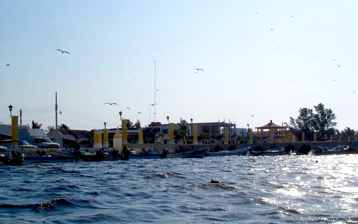
    San Felipe, el puerto donde las leyendas cobran vida

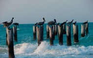
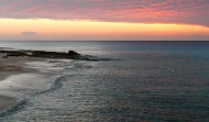
    San Felipe antiguo puerto maya declarado reserva de la biósfera y exquisito en gastronomía.

    Mas información

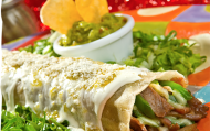
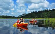
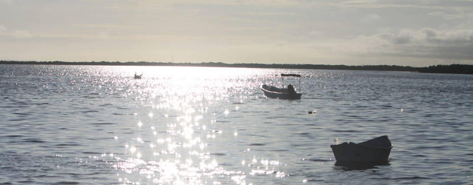
    Entre los puntos a visitar en el puerto se encuentran la ría y la Isla de Cerritos donde podrá observar la belleza y diversidad de su flora y fauna. No puede omitir probar su regional y exquisita cocina, entre sus delicias y como platillo principal le recomendamos probar el famoso ?confeti?.

    Ubicación y Actividades

    San Felipe,Yucatan. Familia

    Precio

    Los paseos por la ría se ofrecen por los lugareños y dado el caso que no es un servicio formal los precios están a disposición y criterio de quién lo ofrece.

    Como llegar

    Desde Mérida se puede llegar:
    • En auto tomando la carretera Mérida-Motul-Tizimín No. 176 hasta llegar a Tizimín, de allí debe tomar la carretera Tizimín- Río Lagartos No. 295 hasta llegar al entronque San Felipe-Río Lagartos- Coloradas, de allí debe tomar la carretera a San Felipe. En total son 197km. 
    • En autobús se llega tomando el autobús con ruta Mérida-Río Lagartos-San Felipe en la terminal de autobuses del noreste ubicada en la calle 67 N 551, Centro, Mérida.

    Horarios

    Se puede entrar al puerto las 24 horas.

    Recomendaciones e Información

    San Felipe cuenta con normas de seguridad para sus habitantes y turistas. Usted como turista debe considerar llevar ropa cómoda y bloqueador solar si pretende estar a la orilla de la playa o tomar un baño, para hacer una fogata en la playa es necesario solicitar un permiso en el palacio municipal. Por su seguridad no debe bañarse en la playa si acaba de comer o si ya ha ingerido bebidas alcohólicas en exceso, después de las 5 de la tarde queda prohibido consumir alcohol en toda la playa, las playas no son nudistas, no estacionar su vehículo muy cerca de la orilla de la playa, podría quedar atascado, no puede conducir ningún vehículo a la orilla de la playa, no está permitido entrar caballos a la playa. Para el muelle de pescadores: no se puede ingerir bebidas alcohólicas, no se puede cortar pescado en los muros de éste, no deje basura o residuos de pescado, no está permitido meter vehículos, no arrojar basura al mar. Banderines en la playa: color verde significa que está permitido bañarse, color amarillo significa que hay que tener precaución a la hora de bañarse y el color rojo significa que está prohibido bañarse. Recuerda que es importante respetar y mantener limpio el espacio que estás visitando.

    Servicios

    Cuenta con servicios de hotel, restaurant, parador turístico, paseos en lancha y sanitarios.

    Sitios Cercanos de Interés

    Puede visitar: Río lagartos reserva de la biósfera, Dzilam de Bravo, El Cuyo, Tizimín, son sólo unos sitios que puede conocer como complemento de su visita a San Felipe.

    Sitio Web

    www.sanfelipeyucatan.com
    comments powered by Disqus
    San Felipe
    '+'

    '+'

    '+'
    '+''; infowindow = new google.maps.InfoWindow({content: contentString}); $(".btnlocation").click(function(){ showMyPosition(); }); $("#pinsdebusquedaclose").click( function(event){ event.preventDefault(); $("#pinsdebusquedaclose").hide(); $("#pinsdeseccion").show(); $("#pinsdebusqueda").hide(); searchingpins=false; showhide(); } ); $("#frmMaps").submit(function(){ if(searchingpins==false){ var tags = $("#frmMaps .txtbuscar").val(); if(tags==''){ // escriba el termino de busqueda }else{ if(ultimabusqueda != tags){ $("#pinsdebusquedaresults").html(""); $("#pinsdebusquedaclose").show(); $("#pinsdeseccion").hide(); $("#pinsdebusqueda").show(); $("#pinsdebusquedawait").show(); $.post("buscarmarcadores.php",{tags:tags},function(data){ $("#pinsdebusquedawait").hide(); $("#pinsdebusquedaresults").html(data); searchingpins=false; showhide(); }); searchingpins=true; }else{ $("#pinsdebusquedaclose").show(); $("#pinsdeseccion").hide(); $("#pinsdebusqueda").show(); } ultimabusqueda = tags; } } return false; }); showhide(); } /** * Data for the markers consisting of a name, a LatLng and a zIndex for * the order in which these markers should display on top of each * other. */ function showhide(){ for(i in allmarkers) { allmarkers[i].setMap(null); } allmarkers = null; allmarkers = Array(); // show checked Markers if( $('#pinsdebusqueda').is(":visible") ){ selector = 'pinsdebusqueda'; }else{ selector = 'pinsdeseccion'; } var current=''; var enabled=''; var markercollection = Array(); var pin = Array(); $('#'+selector+' .markeritem').each(function(i,item){ current = $(this); enabled = current.is(':checked'); if( enabled ){ pin = []; pin.push( current.attr('data-title') ); pin.push( current.attr('data-lat') ); pin.push( current.attr('data-lng') ); pin.push( current.attr('data-icon') ); pin.push( current.attr('data-anim') ); markercollection.push( pin ); } }); setMarkers(map, markercollection, 'images/icons/marker.png'); } function setMarkers(map, locations, markerimage) { // Add markers to the map // Marker sizes are expressed as a Size of X,Y // where the origin of the image (0,0) is located // in the top left of the image. // Origins, anchor positions and coordinates of the marker // increase in the X direction to the right and in // the Y direction down. var imagesize = new google.maps.Size(45, 64); var imageorigin = new google.maps.Point(0,0); var imageanchor = new google.maps.Point(22, 64); var image = { url: markerimage, // This marker is 20 pixels wide by 32 pixels tall. size: imagesize, // The origin for this image is 0,0 origin: imageorigin, // The anchor for this image is the base of the flagpole at 0,32. anchor: imageanchor }; var shadow = { url: markerimage, // The shadow image is larger in the horizontal dimension // while the position and offset are the same as for the main image. size: new google.maps.Size(45, 64), origin: new google.maps.Point(0,0), anchor: new google.maps.Point(0, 64) }; // Shapes define the clickable region of the icon. // The type defines an HTML <area> element 'poly' which // traces out a polygon as a series of X,Y points. The final // coordinate closes the poly by connecting to the first // coordinate. var shape = { coord: [1, 1, 1, 50, 40, 50, 40 , 1], type: 'poly' }; var lastimgsrc=''; for (var i = 0; i '+'
    '+'
    '+'

    '+'

    '+myloc[0]+'

    '+'
    '+''; google.maps.event.addListener(marker, 'click', function() { infowindow.setContent(this.html); infowindow.open(map, this); }); allmarkers.push(marker); } } function showMyPosition(){ // Try HTML5 geolocation if(navigator.geolocation) { navigator.geolocation.getCurrentPosition(function(position) { var pos = new google.maps.LatLng(position.coords.latitude, position.coords.longitude); var infowindow = new google.maps.InfoWindow({map: map,position: pos,content: 'Tu posición actual'}); map.setCenter(pos); }, function() { handleNoGeolocation(true); }); } else { // Browser doesn't support Geolocation handleNoGeolocation(false); } } function handleNoGeolocation(errorFlag) { if (errorFlag) { var content = 'Error: Servicio de Geolocalizacion no disponible.'; } else { var content = 'Error: Tu navegador no es compatible con geolocalizacion.'; } var options = {map: map,position:new google.maps.LatLng(60, 105),content:content}; var infowindow = new google.maps.InfoWindow(options); map.setCenter(options.position); } // The function to trigger the marker click, 'id' is the reference index to the 'markers' array. var lastmarker=null; function showInfo(lat,lng){ pos=-1; if(lastmarker!=null){ allmarkers[lastmarker].setAnimation(null); } $('#'+selector+' .markeritem').each(function(i,item){ current = $(this); if( current.is(':checked') ){ pos++; } if( lat == current.attr('data-lat') && lng == current.attr('data-lng')){ lastmarker=pos; google.maps.event.trigger(allmarkers[pos], 'click'); allmarkers[pos].setAnimation(google.maps.Animation.BOUNCE); return false; } }); } google.maps.event.addDomListener(window, 'load', initialize);

    Mapa

    ¿Donde estoy?
    [+]
    [+]
    [+]
    [+]
    Ver mapa en pantalla completa Ver mapa en pantalla completa

    Mas sugerencias