This is an example of a HTML caption with a link.

Artículos mas leídos

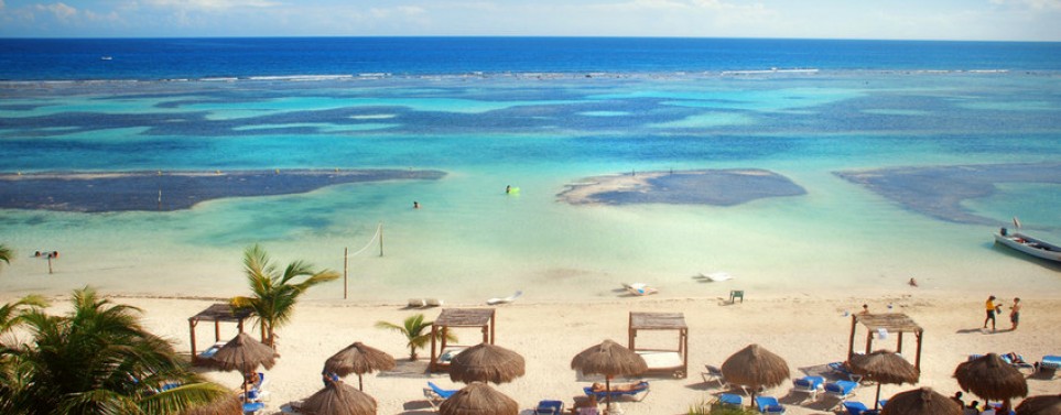
    Majahual

    El último puerto virgen del caribe Maya.

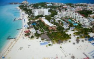
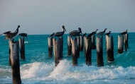
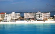
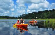
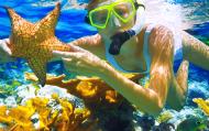
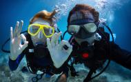
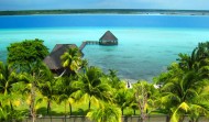
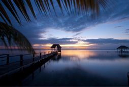
    Situados frente al mar Caribe, pasear a lo largo del hermoso malecon de Mahahual lleno de vida y color, cualquier momento es bueno para hacer una inmersión con los amigos, o enseñar este mundo a los mas nuevos, avalados por la mayor escuela de buceo del mundo. Buceos en el arrecife de Mahahual, tours a Banco Chinchorro, Snorkel, Buceos nocturnos, Pesca de Pez León, Cursos de Buceo, o simplemente disfrutar de un maravilloso masaje en la playa, practicar Kite Surf y aprovechar las ofertas del mercado de artesanías, en Mahahual la oferta para unas buenas vacaciones es muy amplia.

    Mas información

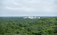
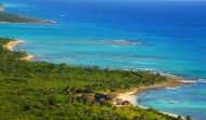
    Uno de los principales atractivos de Mahahual es su cercanía con el Banco Chinchorro, un atolón coralino declarado reserva natural, y la segunda barrera de arrecife más grande del mundo (después de la Gran barrera de coral en Australia). Este arrecife se sitúa en el Mar Caribe frente a las costas de Quintana Roo y Belice, teniendo una enorme biodiversidad sumamente atractiva para bucear en ella. Así mismo se encuentra rodeada por grandes extensiones de selva virgen.

    Ubicación y Actividades

    Mahahual,Quintana Roo. Playa, Buceo, Artesanias.

    Como llegar

    Desde Mérida se llega en auto tomando la carretera Mérida- Valladolid No.180 hasta llegar al entronque con la carretera a Acanceh de allí se toma la carretera Acanceh- Peto (No.18) librando el poblado de Peto hasta llegar al entronque con la carretera José María Morelos. De allí se toma la carretera José María Morelos- Tzucacab (No.184) hasta llegar al entronque con la carretera a Felipe Carrillo Puerto, se toma esa carretera para llegar a dicho pueblo, de allí se toma la carretera Cancún- Chetumal No.307 hasta llegar al entronque con la carretera a Mahahual y se toma la misma hasta llegar al puerto.

    De Cancún, se viaja hacia el sur por la carretera a Chetumal hasta llegar al entronque con Majahual, que se toma hacia la izquierda.

    Recomendaciones e Información

    Esta playa es para descansar y disfrutar del día, no es una playa nudista, no está permitido ingerir bebidas alcoholicas despúes de las 5 de la tarde el la playa, no bañarse en la playa si ha comido o bebido alcohol en exceso, importante llevar ropa cómoda y bloqueador solar si pretende estar a la orilla de la playa o tomar un baño. No puede conducir ningún vehículo a la orilla de la playa, no está permitido entrar caballos a la playa. Para el muelle de pescadores: no se puede ingerir bebidas alcoholicas, no se puede cortar pescado en los muros o bancadas de este, no deje basura o residuos de pescado, no está permitido meter vehículos, no arrojar basura al mar. Banderines en la playa: color verde significa que está permitido bañarse, color amarillo significa que hay que tener precaución a la hora de bañarse y el color rojo significa que está prohibido bañarse. Recuerda que es importante respetar y mantener limpio el espacio que estás visitando.

    Sitios Cercanos de Interés

    Xcalak, Banco Chinchorro, El Uvero, Bacalar y Chetumal
    comments powered by Disqus
    Majahual
    '+'

    '+'

    '+'
    '+''; infowindow = new google.maps.InfoWindow({content: contentString}); $(".btnlocation").click(function(){ showMyPosition(); }); $("#pinsdebusquedaclose").click( function(event){ event.preventDefault(); $("#pinsdebusquedaclose").hide(); $("#pinsdeseccion").show(); $("#pinsdebusqueda").hide(); searchingpins=false; showhide(); } ); $("#frmMaps").submit(function(){ if(searchingpins==false){ var tags = $("#frmMaps .txtbuscar").val(); if(tags==''){ // escriba el termino de busqueda }else{ if(ultimabusqueda != tags){ $("#pinsdebusquedaresults").html(""); $("#pinsdebusquedaclose").show(); $("#pinsdeseccion").hide(); $("#pinsdebusqueda").show(); $("#pinsdebusquedawait").show(); $.post("buscarmarcadores.php",{tags:tags},function(data){ $("#pinsdebusquedawait").hide(); $("#pinsdebusquedaresults").html(data); searchingpins=false; showhide(); }); searchingpins=true; }else{ $("#pinsdebusquedaclose").show(); $("#pinsdeseccion").hide(); $("#pinsdebusqueda").show(); } ultimabusqueda = tags; } } return false; }); showhide(); } /** * Data for the markers consisting of a name, a LatLng and a zIndex for * the order in which these markers should display on top of each * other. */ function showhide(){ for(i in allmarkers) { allmarkers[i].setMap(null); } allmarkers = null; allmarkers = Array(); // show checked Markers if( $('#pinsdebusqueda').is(":visible") ){ selector = 'pinsdebusqueda'; }else{ selector = 'pinsdeseccion'; } var current=''; var enabled=''; var markercollection = Array(); var pin = Array(); $('#'+selector+' .markeritem').each(function(i,item){ current = $(this); enabled = current.is(':checked'); if( enabled ){ pin = []; pin.push( current.attr('data-title') ); pin.push( current.attr('data-lat') ); pin.push( current.attr('data-lng') ); pin.push( current.attr('data-icon') ); pin.push( current.attr('data-anim') ); markercollection.push( pin ); } }); setMarkers(map, markercollection, 'images/icons/marker.png'); } function setMarkers(map, locations, markerimage) { // Add markers to the map // Marker sizes are expressed as a Size of X,Y // where the origin of the image (0,0) is located // in the top left of the image. // Origins, anchor positions and coordinates of the marker // increase in the X direction to the right and in // the Y direction down. var imagesize = new google.maps.Size(45, 64); var imageorigin = new google.maps.Point(0,0); var imageanchor = new google.maps.Point(22, 64); var image = { url: markerimage, // This marker is 20 pixels wide by 32 pixels tall. size: imagesize, // The origin for this image is 0,0 origin: imageorigin, // The anchor for this image is the base of the flagpole at 0,32. anchor: imageanchor }; var shadow = { url: markerimage, // The shadow image is larger in the horizontal dimension // while the position and offset are the same as for the main image. size: new google.maps.Size(45, 64), origin: new google.maps.Point(0,0), anchor: new google.maps.Point(0, 64) }; // Shapes define the clickable region of the icon. // The type defines an HTML <area> element 'poly' which // traces out a polygon as a series of X,Y points. The final // coordinate closes the poly by connecting to the first // coordinate. var shape = { coord: [1, 1, 1, 50, 40, 50, 40 , 1], type: 'poly' }; var lastimgsrc=''; for (var i = 0; i '+'
    '+'
    '+'

    '+'

    '+myloc[0]+'

    '+'
    '+''; google.maps.event.addListener(marker, 'click', function() { infowindow.setContent(this.html); infowindow.open(map, this); }); allmarkers.push(marker); } } function showMyPosition(){ // Try HTML5 geolocation if(navigator.geolocation) { navigator.geolocation.getCurrentPosition(function(position) { var pos = new google.maps.LatLng(position.coords.latitude, position.coords.longitude); var infowindow = new google.maps.InfoWindow({map: map,position: pos,content: 'Tu posición actual'}); map.setCenter(pos); }, function() { handleNoGeolocation(true); }); } else { // Browser doesn't support Geolocation handleNoGeolocation(false); } } function handleNoGeolocation(errorFlag) { if (errorFlag) { var content = 'Error: Servicio de Geolocalizacion no disponible.'; } else { var content = 'Error: Tu navegador no es compatible con geolocalizacion.'; } var options = {map: map,position:new google.maps.LatLng(60, 105),content:content}; var infowindow = new google.maps.InfoWindow(options); map.setCenter(options.position); } // The function to trigger the marker click, 'id' is the reference index to the 'markers' array. var lastmarker=null; function showInfo(lat,lng){ pos=-1; if(lastmarker!=null){ allmarkers[lastmarker].setAnimation(null); } $('#'+selector+' .markeritem').each(function(i,item){ current = $(this); if( current.is(':checked') ){ pos++; } if( lat == current.attr('data-lat') && lng == current.attr('data-lng')){ lastmarker=pos; google.maps.event.trigger(allmarkers[pos], 'click'); allmarkers[pos].setAnimation(google.maps.Animation.BOUNCE); return false; } }); } google.maps.event.addDomListener(window, 'load', initialize);

    Mapa

    ¿Donde estoy?
    [+]
    [+]
    [+]
    [+]
    Ver mapa en pantalla completa Ver mapa en pantalla completa

    Mas sugerencias