Dzibilchaltún
This is an example of a HTML caption with a link.

Artículos mas leídos

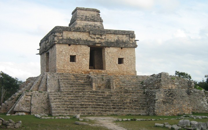
    Dzibilchaltún

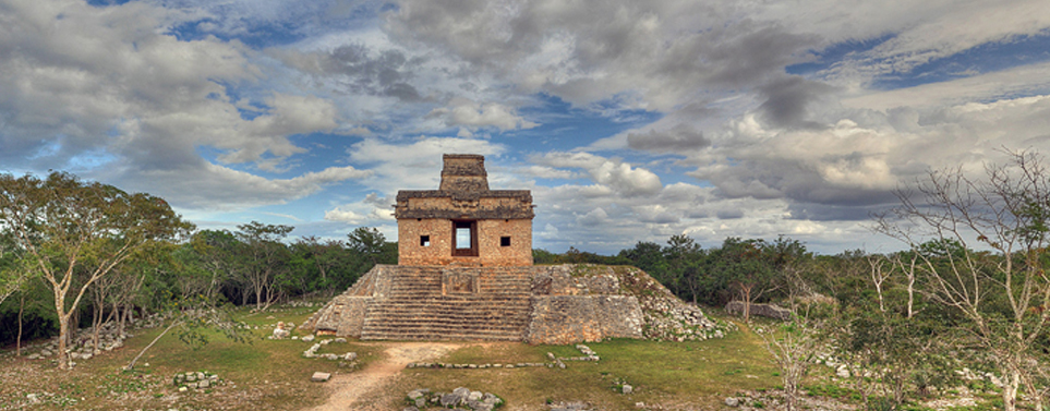
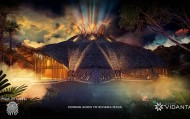
    Donde el sol brilla a través del templo...

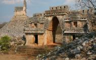
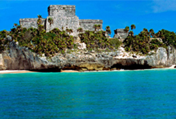
    Dzibilchaltún significa en lengua maya "lugar donde hay escritura en las piedras", en alusión a las numerosas lápidas conmemorativas encontradas en el sitio, llamadas también estelas. Según los expertos, hubo asentamientos desde el año 500 a.C., es posible que desde antes, y perduró hasta la conquista de los españoles alrededor del año 1540 d.C.

    Mas información

    Considerada una de las ciudades más antiguas de la cultura maya, Dzibilchaltún es un sitio lleno de historias que vale la pena descubrir. 
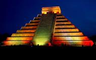
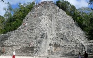
    Durante el equinoccio (cada 21 de marzo y 22 de septiembre), el templo principal ofrece un espectáculo único de luz y sombras en que el sol se deja ver a través de la venta central del edificio.
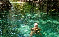
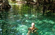
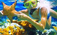
    Su cenote Xlacah, en el centro de la zona arqueológica,  es uno de los más grandes y profundos de Yucatán, y es el único sitio maya donde hay un cenote abierto al público. Sus aguas cristalinas y sus lirios en la superficie hacen un ambiente perfecto para nadar en armonía con la naturaleza y con la historia.

    Ubicación y Actividades

    Dzibilchaltún,Yucatan. Sitio arqueológico.

    Precio

    Admisión general $118
    Nacionales $91
    Niños menores de 13 años $6
    Tercera edad con INAPAN $18
    Los domingos la entrada es gratuita para los nacionales.

    Como llegar

    Se localiza a 16 km al norte de Mérida, en auto se toma la carretera Mérida-Progreso hacia el norte después de 12 km se verá el señalamiento de doblar hacia la derecha, conducirá por cerca de 4 km y se verá a la derecha la entrada al sitio. En autobus se aborda en la terminal de Autoprogreso con horarios de salida de 7am y 11 am y el boleto cuesta $8.00

    Horarios

    Abierto todos los días de 8 am a 5 pm.

    Recomendaciones e Información

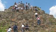
    Si quiere disfrutar al máximo de su visita a Dzibilchaltún debe seguir éstas recomendaciones: asegurese de llevar un sombrero, bloqueador solar. NO esta permitido subirse a las pirámides. Hay guías de turistas no-oficiales en la entrada, que se pueden contratar individualmente. Es recomendable llevar calzado deportivo para que puede caminar y recorrer el sitio sin problemas. Informese bien del clima para que la lluvia no arruine su visita. Recuerda que es importante respetar y mantener limpio el espacio que estás visitando.

    Servicios

    Cuenta con servicio de guía de turistas (oficiales y no oficiales), sanitarios para cambiarse si desea bañarse en el cenote, tienda de recuerdos.

    Sitios Cercanos de Interés

    Progreso que se encuentra aproximadamente a unos 20 kilómetros como puerto principal es una buena opción para visitar tanto sus playas como la cuidad o simplemente para ir de compras.

    Sitio Web

    No Disponible

    Email

    No Disponible
    comments powered by Disqus
    Dzibilchaltún
    '+'

    '+'

    '+'
    '+''; infowindow = new google.maps.InfoWindow({content: contentString}); $(".btnlocation").click(function(){ showMyPosition(); }); $("#pinsdebusquedaclose").click( function(event){ event.preventDefault(); $("#pinsdebusquedaclose").hide(); $("#pinsdeseccion").show(); $("#pinsdebusqueda").hide(); searchingpins=false; showhide(); } ); $("#frmMaps").submit(function(){ if(searchingpins==false){ var tags = $("#frmMaps .txtbuscar").val(); if(tags==''){ // escriba el termino de busqueda }else{ if(ultimabusqueda != tags){ $("#pinsdebusquedaresults").html(""); $("#pinsdebusquedaclose").show(); $("#pinsdeseccion").hide(); $("#pinsdebusqueda").show(); $("#pinsdebusquedawait").show(); $.post("buscarmarcadores.php",{tags:tags},function(data){ $("#pinsdebusquedawait").hide(); $("#pinsdebusquedaresults").html(data); searchingpins=false; showhide(); }); searchingpins=true; }else{ $("#pinsdebusquedaclose").show(); $("#pinsdeseccion").hide(); $("#pinsdebusqueda").show(); } ultimabusqueda = tags; } } return false; }); showhide(); } /** * Data for the markers consisting of a name, a LatLng and a zIndex for * the order in which these markers should display on top of each * other. */ function showhide(){ for(i in allmarkers) { allmarkers[i].setMap(null); } allmarkers = null; allmarkers = Array(); // show checked Markers if( $('#pinsdebusqueda').is(":visible") ){ selector = 'pinsdebusqueda'; }else{ selector = 'pinsdeseccion'; } var current=''; var enabled=''; var markercollection = Array(); var pin = Array(); $('#'+selector+' .markeritem').each(function(i,item){ current = $(this); enabled = current.is(':checked'); if( enabled ){ pin = []; pin.push( current.attr('data-title') ); pin.push( current.attr('data-lat') ); pin.push( current.attr('data-lng') ); pin.push( current.attr('data-icon') ); pin.push( current.attr('data-anim') ); markercollection.push( pin ); } }); setMarkers(map, markercollection, 'images/icons/marker.png'); } function setMarkers(map, locations, markerimage) { // Add markers to the map // Marker sizes are expressed as a Size of X,Y // where the origin of the image (0,0) is located // in the top left of the image. // Origins, anchor positions and coordinates of the marker // increase in the X direction to the right and in // the Y direction down. var imagesize = new google.maps.Size(45, 64); var imageorigin = new google.maps.Point(0,0); var imageanchor = new google.maps.Point(22, 64); var image = { url: markerimage, // This marker is 20 pixels wide by 32 pixels tall. size: imagesize, // The origin for this image is 0,0 origin: imageorigin, // The anchor for this image is the base of the flagpole at 0,32. anchor: imageanchor }; var shadow = { url: markerimage, // The shadow image is larger in the horizontal dimension // while the position and offset are the same as for the main image. size: new google.maps.Size(45, 64), origin: new google.maps.Point(0,0), anchor: new google.maps.Point(0, 64) }; // Shapes define the clickable region of the icon. // The type defines an HTML <area> element 'poly' which // traces out a polygon as a series of X,Y points. The final // coordinate closes the poly by connecting to the first // coordinate. var shape = { coord: [1, 1, 1, 50, 40, 50, 40 , 1], type: 'poly' }; var lastimgsrc=''; for (var i = 0; i '+'
    '+'
    '+'

    '+'

    '+myloc[0]+'

    '+'
    '+''; google.maps.event.addListener(marker, 'click', function() { infowindow.setContent(this.html); infowindow.open(map, this); }); allmarkers.push(marker); } } function showMyPosition(){ // Try HTML5 geolocation if(navigator.geolocation) { navigator.geolocation.getCurrentPosition(function(position) { var pos = new google.maps.LatLng(position.coords.latitude, position.coords.longitude); var infowindow = new google.maps.InfoWindow({map: map,position: pos,content: 'Tu posición actual'}); map.setCenter(pos); }, function() { handleNoGeolocation(true); }); } else { // Browser doesn't support Geolocation handleNoGeolocation(false); } } function handleNoGeolocation(errorFlag) { if (errorFlag) { var content = 'Error: Servicio de Geolocalizacion no disponible.'; } else { var content = 'Error: Tu navegador no es compatible con geolocalizacion.'; } var options = {map: map,position:new google.maps.LatLng(60, 105),content:content}; var infowindow = new google.maps.InfoWindow(options); map.setCenter(options.position); } // The function to trigger the marker click, 'id' is the reference index to the 'markers' array. var lastmarker=null; function showInfo(lat,lng){ pos=-1; if(lastmarker!=null){ allmarkers[lastmarker].setAnimation(null); } $('#'+selector+' .markeritem').each(function(i,item){ current = $(this); if( current.is(':checked') ){ pos++; } if( lat == current.attr('data-lat') && lng == current.attr('data-lng')){ lastmarker=pos; google.maps.event.trigger(allmarkers[pos], 'click'); allmarkers[pos].setAnimation(google.maps.Animation.BOUNCE); return false; } }); } google.maps.event.addDomListener(window, 'load', initialize);

    Mapa

    ¿Donde estoy?
    [+]
    [+]
    [+]
    [+]
    Ver mapa en pantalla completa Ver mapa en pantalla completa

    Mas sugerencias